Polygon Creation Guide
Introduction
While the Proclamation and colonial instructions regarding the protocols for taking land surrenders in Upper Canada were specific and detailed, their application on the ground was not always as clear-cut. Several elements of the established protocols were respected, specifically the need for an official of the Indian Department to conduct the negotiations in a public manner with those Aboriginal people who were believed to hold land interests. Other elements, however, were not, as Peter Schmalz explains in his study of the Ojibway in southern Ontario. He identifies three main problems with these treaties: the description of the lands purchased were often vague; cessions from a specific group often covered lands used by others; and some groups surrendered lands to which they held no interests. -Morin, Jean-Pierre. “Concepts of Extinguishment in the Upper Canada Land Surrender Treaties, 1764–1862” (2013). pg 26[1]
Interpreting the treaty documents toward creating polygons for this project’s interactive map can be an indefinite task. Success may not be guaranteed when you decide to begin working on a particular treaty - lines and boundaries might be blurrier than expected, and when you finally connect the dots, there may be doubts, challenges and questions that loom. One of the primary functions of this wiki environment is to create a space to discuss and adjust the interpretations of the source documents, and so there will be as much work in adjusting polygons as there is in creating them in the first place. All that is to say: Give it your best shot. Communicate the reasonings behind your interpretations and polygons as much as warranted and take solace in the fact that others may catch an inaccuracy and provide alternatives. If you are stumped and are not able to complete a polygon for a treaty, provide resources and avenues of research that you have pursued to help others in the future who may tackle that treaty. A treaty’s Talk or Discussion page is a good place for any such background research, questions, and discussions.
The following guide follows work on treaties 24, 28.5 and 30. In the guide, you will find different steps and processes involved in creating polygons for the treaties. It is important to remember that the results are the author’s interpretation and are welcoming of necessary adjustments.
It is also important to note that there will be other helpful techniques and lines of research that are not included in this guide. It is encouraged that users share any techniques and methods through treaty Talk pages as well as in this guide.
24
A completed transcription of the source document is extremely helpful in creating polygons. For help on this, see the Transcription Guide.
A helpful preliminary step is to use keyword searches to find other relevant resources and information on the treaty for which a polygon is being created. Helpful keywords to use include the treaty number or any alternate names it may have (for example, Treaty #13, also known as the Toronto Purchase), the year or full date, and other relevant query parameters.

In this case, the treaty number and date revealed other relevant pages and analyses of the text. These kinds of resources can help provide contexts, hints and other references and corroborations in creating a polygon. In some cases, others may have even already mapped the treaty and shared the polygons as shapefiles or maps which can be traced and referenced, for example see Treaty #10.
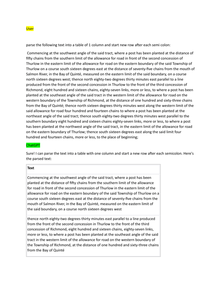
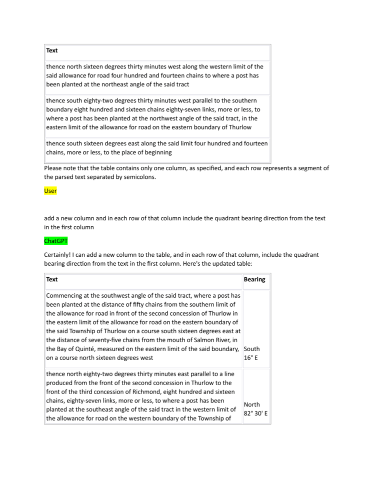
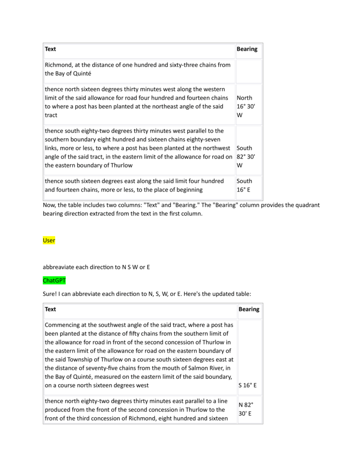
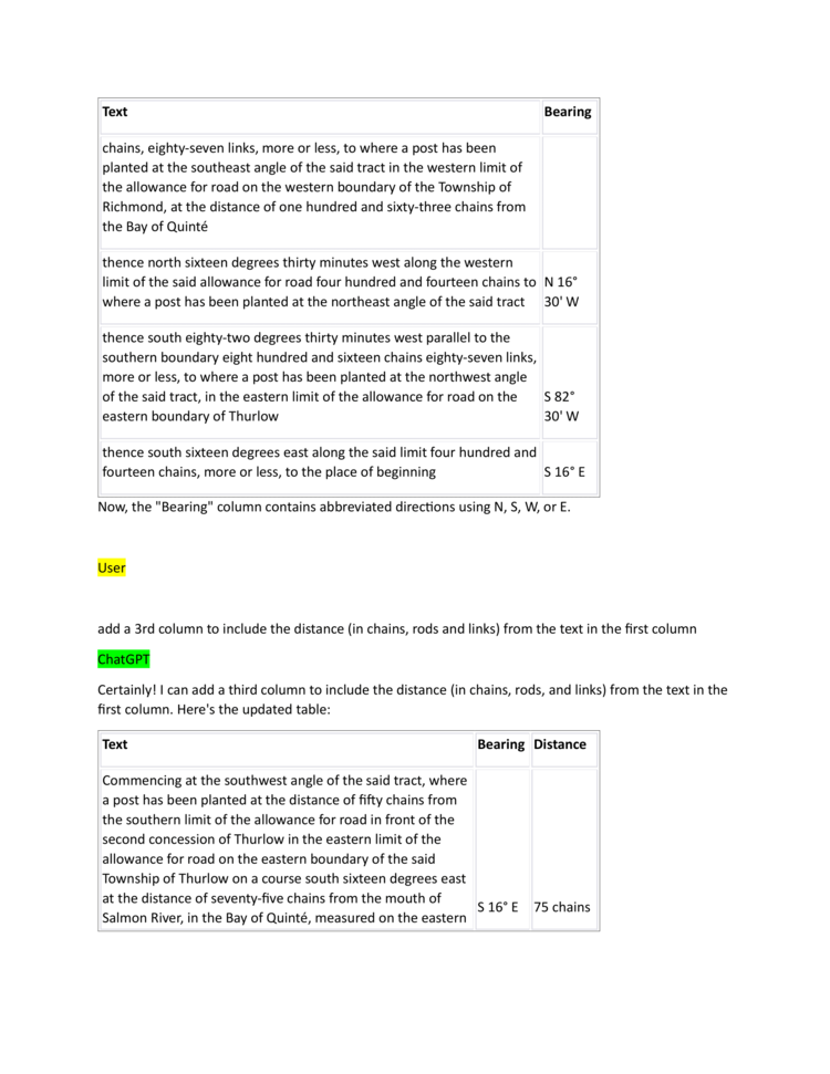
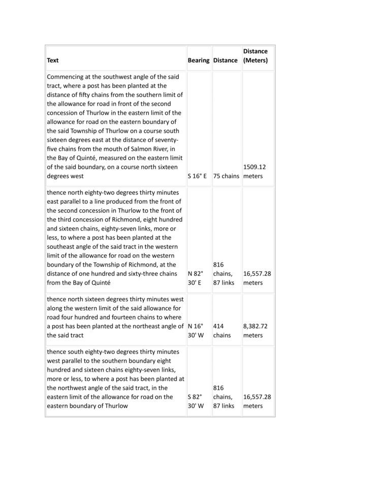
Often, it is necessary to follow the metes and bounds descriptions from the treaty text in creating a polygon for the treaty. It may be easier to parse the text into a table where the directional bearings and distances can be easily referenced and organized, and the Gunter’s Chains measurements can be converted to meters.

In analyzing metes and bounds descriptions, it is helpful to use maps and other GIS reference tools in order to follow along. For this treaty #24, this Ontario GeoHub Lot Fabric database is helpful as it contains the georeferenced lot and concession information referenced in the metes and bounds description.
Often the subjects of treaty texts are the lots and concessions themselves (certain lots in certain concessions), in which case a database like ON GeoHub can be used to trace the relevant boundaries (for example treaties 15, 28, 32, 34 in East Hawkesbury, ON, and 26 and 33 in Innisfil, ON).
Using maps and reference databases, it is helpful to add notes to the tables of parsed metes and bounds descriptions. These helpful tables should be published on the treaty’s talk page, in this case: Talk:24. These notes are helpful to begin measuring and sketching the polygon on a map.

Look at the images in the following slideshow to see some of the steps in this process:
- Sketching and Measuring
-
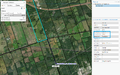 Commencement point. The highlighted lot is the eastern most lot on Thurlow Concession 2, from which 50 chains (~1005 meters) was measured to find the commencement point where the post referred to in the treaty text had been placed.
 -
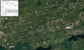 Southern boundary sketch. Following parallel the road allowance referenced in the text for ~816 chains brings us along the the jog in the Tyendinaga Concession 1 South of the Road to the Richmond boundary line.
 -
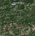 Eastern boundary sketch. Following along the road allowance between Tyendinaga and Richmond for ~414 chains
 -
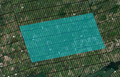 Finished polygon.


The above processes can be slow and cumbersome, and often the tract descriptions so can be so vague so as to be impossible to put on a map. However the process can be rewarding with any small success, and it can be interesting to see how the words in these documents have created, erased or otherwise interacted with certain landmarks, often seen today in over-grown tree-lines, jogs in roads, irregularly shaped fields and quarries and more.
If you were unsuccessful in creating the polygon but have gathered a number of resources and did some analyses that would be helpful for others to see toward creating the polygon? Add them to the treaty's Talk page for future contributors to try and work on. For example see Treaty 28.5 and its Talk:28.5 page
If you are successful in creating a polygon, get in touch! You can send the polygon to the project administrators in a variety of formats, shapefiles (.shp), KML (.kml), other geographic data files, or even images of the polygons.
Using AI to help with parsing metes and bounds descriptions into tables.
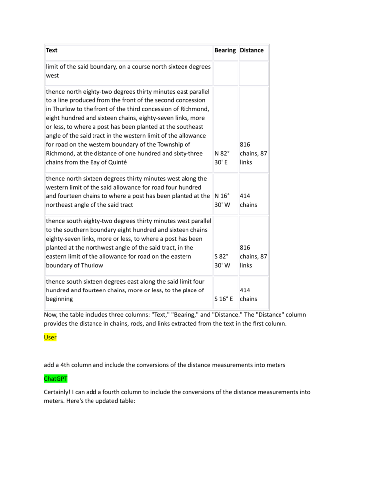
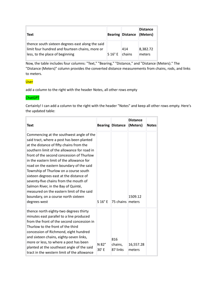
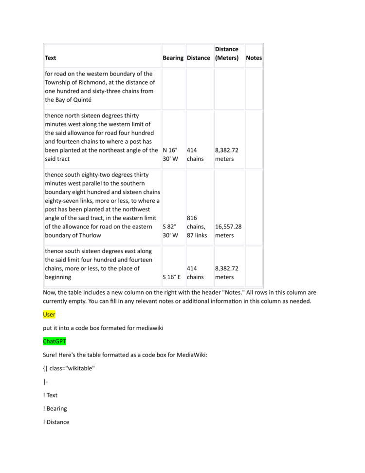
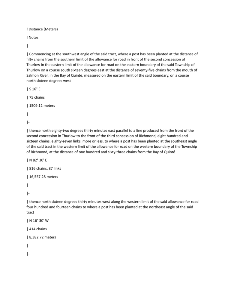
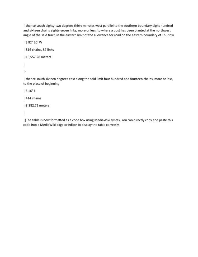
Creating such tables can be time consuming, AI platforms and other editing software may help speed up these tasks. See the following gallery chat with an AI bot which helped process some of the creating of the Talk:24's metes and bounds table.
- Using AI
-
-
-
-
-
-
-
-
-
-


28.5
As in working on treaty 24 above, beginning treaty 28.5 started with transcribing the source documents and parsing the metes and bounds description. To do so, the .txt file of the OCR-Tesseract transcription was downloaded and edited against the .png files of the original source documents. All the files were available on the treaty’s page (old version).
Treaty 28.5 - Parsed metes and bounds
| Text | Directional Bearing | Distance (Gunter's Chains) | Distance (Meters) | Notes |
|---|---|---|---|---|
| commencing on the south side of the said river at the easterly angle of lands owned by Elizabeth Clench at the water’s edge | ||||
| then south sixty-five degrees west one hundred and six chains | S 65° W | 106 | 2132.40 | |
| then south twenty-seven degrees west one hundred and sixty chains | S 27° W | 160 | 3218.68 | |
| then south sixty-two degrees and thirty minutes east one hundred and twenty chains | S 62° 30' E | 120 | 2414.02 | |
| then north twenty-seven degrees and thirty minutes east one hundred and sixty chains | N 27° 30' E | 160 | 3218.68 | |
| then north sixty-five degrees east sixty-two chains, more or less, to the said Grand River | N 65° E | 62 | 1247.26 | |
| then up the said river against the stream, its several courses and windings, to the place of beginning |
The directions in the above table are fairly simple and include some reference land marks including the Grand River and Elizabeth Clench’s property. To be able to follow these metes and bounds directions, however, is will be necessary to know the location of the “easterly angle” of the Clench property.
Research revealed the following resources:
- History of Brant book 1920 mentions Chief Clench on page 56 "The Corner Store":
- http://images.ourontario.ca/Partners/cbpl/CBPL0831291T.PDF
- "Miss Clench" mentioned on page 206 "Noteable event on Mt. Pleasant"
- "Ralph Clench" mentioned on pg 330
- http://images.ourontario.ca/Partners/cbpl/CBPL0831291T.PDF
- Elizabeth and Ralfe Clench and their children, Jemima Stewart and her husband and children mentioned many times in these searchable records:
- Haldimand County historic map from 1863 with property owner names, can't find Clench property
- Ralfe clench Biography
- Cultural impact assesment of 241 Johnson street talks about the "Clench House", but this is in Niagara on the lake:
- Clenches mentioned here:
- https://www.ontariogenealogy.com/uppercanadanewspapernotices.html
- Says Ralfe Clench died 1828, and Mrs. Ralfe (nee Johnson) died 1850
- Ralfe Clench Wiki page talks about Elizabeth, but Clench house is in Niagara not Grand River, Elizabeth is daught of William Johnson and Molly Brant:
- https://www.ontariogenealogy.com/uppercanadanewspapernotices.html
None of the above resources were able to provide the location of Elizabeth Clench’s property and its easterly angle. Without that information, the metes and bounds table is not useable, and so this attempt at creating a polygon for treaty 28.5 has failed. Before moving on to work on a different treaty, the above resources were added to the treaty’s talk page (old version) for future contributors to use in researching this treaty.
30
Again, as in treaties 24 and 28.5, the process for creating a polygon for treaty 30 starts by transcribing the source document with the files available on the treaty page (old version), followed by creating a table of the metes and bounds description.
Treaty 30 - Parsed metes and bounds
| Metes and Bounds Description | Directional Bearing | Distance (Chains, Links, Rods) | Distance (Meters) | Notes |
|---|---|---|---|---|
| Commencing where a stake has been planted on the north side of the road leading from the Grand River bridge through the village of Brantford towards Ancaster, now called Colborne street, and fifty links on a line bearing north five degrees thirty minutes west magnetically from the north-west angle of the Mohawk Parsonage ground | N 5° 30' W | |||
| Thence north eighteen degrees thirty minutes east magnetically, seventy-nine chains forty-five links, more or less, to a white oak tree | N 18° 30' E | 79 chains, 45 links | 1592.62 m | |
| Thence south eighty-four degrees thirty minutes west magnetically eighty-two chains twenty-eight links, more or less, to where a stake has been planted on the eastern boundary line of William Kenedy Smith’s land | S 84° 30' W | 82 chains, 28 links | 1653.42 m | |
| Thence south twenty-seven degrees thirty minutes west magnetically along the said boundary line fifty-nine chains twenty-six links, more or less, to a certain stone, and northern extremity of Robert Biggar’s land | S 27° 30' W | 59 chains, 26 links | 1190.44 m | |
| Thence south fifteen degrees west magnetically along the eastern boundary line of the said Robert Biggar’s land twenty-eight chains fifty links, more or less, to where a stake has been planted at high water mark on the north side of the Grand -River, or Ouse | S 15° W | 28 chains, 50 links | 570.29 m | |
| Thence along the northern bank of the said river with the stream to a certain white oak tree standing at high water mark sixty-four links below the outlet of Nathan Gage’s saw-mill race | ||||
| Thence north twenty-five degrees fifteen minutes east magnetically twenty-four chains thirty links, more or less, to where a stake has been planted at high water mark on the south bank of a certain cove | N 25° 15' E | 24 chains, 30 links | 486.44 m | |
| Thence along the south bank of the said cove with the stream fourteen chains eight links, more or less, to a cluster of soft maple trees | 14 chains, 8 links | 283.86 m | ||
| Thence north thirty-four degrees forty minutes east magnetically eight chains, more or less, to a certain white oak tree standing on the summit of the main bank on the north side of the said cove | N 34° 40' E | 8 chains | 160.93 m | |
| Then north five degrees thirty minutes west magnetically seven chains fifty-five links, more or less, to within four chains of the south side of the aforesaid road, or Colborne street | N 5° 30' W | 7 chains, 55 links | 156.69 m | |
| Thence north eighty-four degrees thirty minutes east magnetically, and parallel to the said road or street, forty-five chains four links, more or less, to the eastern limit of the said Mohawk Parsonage ground | N 84° 30' E | 45 chains, 4 links | 907.40 m | |
| Thence north five degrees thirty minutes west magnetically five chains, more or less, to the place of beginning | N 5° 30' W | 5 chains | 100.58 m |
The first line of the metes and bounds description mentions the “Mohawk parsonage ground” as a landmark reference to be able to find the starting point of the treaty boundaries. This prompted research to find the location of the parsonage ground in order to follow the rest of the metes and bounds guide, and the research resulted in finding a historic map of Brantford from 1833 by Lewis Burwell.


The map, below, shows the location of the Mohawk parsonage ground as well of other landmarks that are mentioned in the treaty document. By placing the Lewis Burwell 1833 map ontop of a modern map, it is easier to see where the starting point for the polygon will be.

Using the above visual references to coincide with the metes and bounds description, a polygon is created and added to the project map. Relevant research is also posted to the treaty’s talk page to help other reference how the polygon was created and other research that was found in the process.
28.5 revisited
… and did you notice anything in the above Burwell 1833 map that may be a helpful resource in other treaties?

Yes, the Clench property from treaty 28.5 above is shown on the map, and becomes the basis for making another attempt at creating the treaty 28.5 polygon.
- ↑ Morin, Jean-Pierre. “Concepts of Extinguishment in the Upper Canada Land Surrender Treaties, 1764–1862” (2013). pg. 26