274: Difference between revisions
Jump to navigation
Jump to search
No edit summary |
No edit summary |
||
| Line 42: | Line 42: | ||
|} | |} | ||
[[File:Nomapthumbnail.png|thumb|Be a part of this project and contribute a polygon.]] | [[File:Nomapthumbnail.png|thumb|Be a part of this project and contribute a polygon.]] | ||
{{Infobox| name = 274| date = 1889/07/31| prev = 273| next = 275}} | |||
This treaty has not yet been mapped. The Mapping Land Theft project depends on collaboration to populate the map and this wiki-environment with data and analyses, check the [[How to Contribute]] page for details on how to contribute to the project's online map and this wiki-environment. | This treaty has not yet been mapped. The Mapping Land Theft project depends on collaboration to populate the map and this wiki-environment with data and analyses, check the [[How to Contribute]] page for details on how to contribute to the project's online map and this wiki-environment. | ||
Latest revision as of 13:59, 24 April 2024
Index Text
Click "Expand" to expand index table
| ENTRY | YEAR | MONTH | DAY | NO. | FIRSTNATIONSURRENDERING | OTHERSURRENDERER | LOCATIONNAME | COUNTY | INDEXTEXT | PAGE | VOLUME |
|---|---|---|---|---|---|---|---|---|---|---|---|
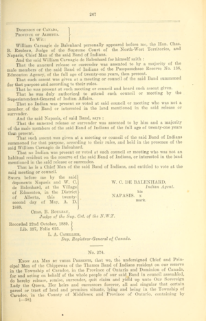
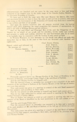
| 205 | 1889 | 7 | 31 | 274 | CHIPPEWA | CARADOC TOWNSHIP | MIDDLESEX | BY CHIPPEWA INDIANS. LOT 9, RANGE 6. TO BE LEASED | 267 | II | |
| 360 | 1889 | 7 | 31 | 274 | CHIPPEWA/OJIBBEWA | CARADOC TOWNSHIP | MIDDLESEX | LOT 9, RANGE 6, CARADOC TOWNSHIP, MIDDLESEX COUNTY. TO BE LEASED | 267 | II |

This treaty has not yet been mapped. The Mapping Land Theft project depends on collaboration to populate the map and this wiki-environment with data and analyses, check the How to Contribute page for details on how to contribute to the project's online map and this wiki-environment.


- ↑ Canada Department of Indian Affairs. Indian Treaties and Surrenders, from 1680-1890. Ottawa: S.E. Dawson printer to the King’s most excellent majesty, 1905.